
With experience of over 37 years in the fuel market, we confidently understand your needs. We source high quality products to service those needs.
We launched GREENHEAT with a single mission in mind, let’s make heat more environmentally friendly.
Our Wood logs are crafted from carefully selected, sustainably sourced wood fibers and natural binders. They are meticulously engineered to burn longer and produce consistent, high heat output, ensuring a cozy and comfortable environment for you and your loved ones.
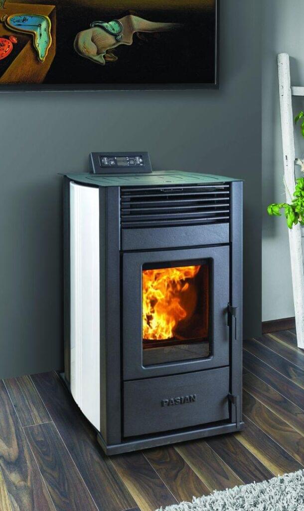
One of the distinguishing features of Italian quality pellet stoves is their advanced combustion technology. These stoves are designed to maximize fuel efficiency and minimize emissions, allowing for cleaner and more sustainable heating. With intelligent control systems, precise temperature regulation, and innovative pellet feeding mechanisms, Italian pellet stoves offer exceptional performance and user-friendly operation.
When it comes to pellet stoves, few can match the unparalleled quality and craftsmanship that Italian manufacturers bring to the table. Renowned worldwide for their attention to detail, innovative designs, and commitment to excellence, Italian pellet stoves are the epitome of reliability and efficiency.
Italian manufacturers of pellet stoves adhere to strict manufacturing standards, ensuring that every aspect of their products meets the highest level of quality. From the selection of premium materials to the meticulous assembly process, every step is carefully executed to deliver a superior heating solution.
FLEX Twin Wall is a range of aluminium flexible pipes, inside and outside corrugated, made by a helicoidal winding of double or more layers of aluminium and insulating material.
There are two versions available:
It is a range of aluminium flexible pipes, inside and outside corrugated, made by a helicoidal winding of double or more layers of aluminium and insulating material. ALA spa makes available to the customers two versions:
Fast delivery
Shop at ease
100% guaranteed
At lowest prices